 |
 |
The Flamborough Lifeboats |
 |
 |
© Simon Robson
1998-2007
Home
Services
Boats..
Pictures
R.N.L.I
Links
History..
Awards..
History Before The R.N.L.I.
This page was |
Misc. |
| Site Map Copyright |
Related |
| Station History Timeline Tragedies |
The massive peninsula of Flamborough Head is situated on the East Coast of Yorkshire, England. It forms one of the most impressive landscapes on this stretch of coastline. The headland extends defiantly into the unforgiving North Sea by approximately six miles.
The chalk cliffs to the north tower up to 400 feet high in places. To the east are coves, sea caves and stacks. To the south the cliffs drop in height but look out over Bridlington Bay. At the base of these cliffs lay razor sharp rocks, boulders as big as a van and wave cut platforms known locally as 'Scars'. Finally rushing around it all, 4 times a day, are currents as dangerous as anywhere to be found in the UK.
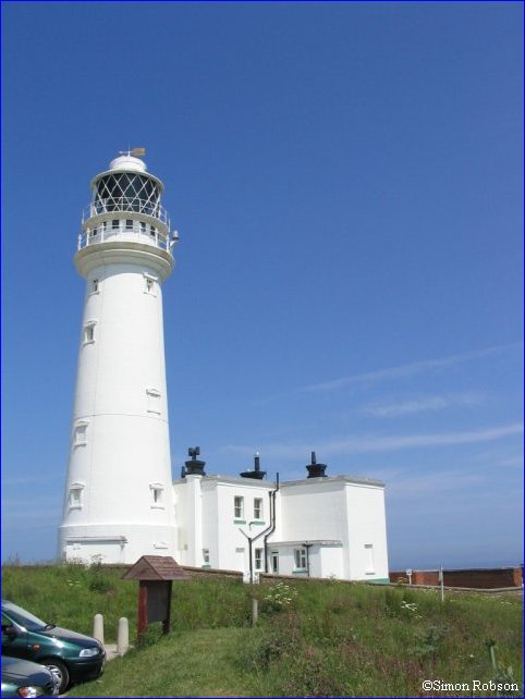 It is hardly surprising to learn that it is recorded, between the years 1770 and 1806, that one hundred and seventy four ships were wrecked in this area. After hearing of the high price paid by passing shipping, Mr Benjamin Milne, Collector of Customs at Bridlington contacted Trinity House. They commissioned Mr. John Matson of Bridlington to build a lighthouse in 1806. The brick built structure was constructed from the inside and without the aid of scaffolding. The lighthouse, standing at ninety two feet high, painted white and two hundred and fourteen feet above sea level is still in operation today. By using a set of glass prisms, mounted in a rotating frame, which sits on a bed of mercury, a light equivalent to three and half million-candle power is visible up to twenty-one miles away. The lighthouse is now fully automated, but guided tours are still taken during the season. The flashing sequence of one red and two white flashes was changed in 1925 to the present day four white flashes, 2½ seconds apart then a 6 second gap.
Mr. Milne's and Mr. Matson's efforts resulted in a reduction in the number of shipwrecks around the head. The records and wreck charts still show numerous casualties occurred between the years of 1813 and 1893. It is further recorded that the bodies forty nine seamen are buried in Flamborough Graveyard, many were unknown.
On the morning of the 10th February 1871 a violent southeasterly gale ravaged the East Coast. The storm was worst in living memory, and caused massive loss of life and shipping in Bridlington Bay. It was estimated by the Royal National Lifeboat Institution, that at least seventy seamen and thirty ships were lost at that time. So terrible was devastation caused that it became known as the 'Tenth of February Gale'. After this catastrophic loss of life the lifeboat stations at Flamborough were formed.
Designed by Simon Robson ©1998-2007
Helmsman - Flamborough Lifeboat Station